


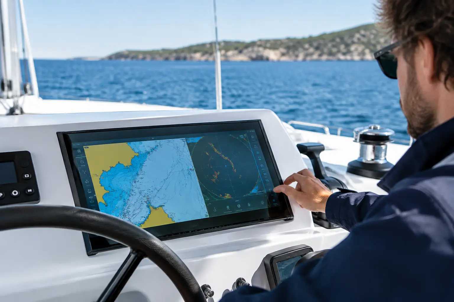
On a catamaran, a chartplotter is not just a map on a screen. It must remain legible from both helm stations, reliably exchange data with radar, AIS, autopilot, and instruments, and operate without interruption when sea conditions are demanding. Therefore, the question of which are the best chartplotters for catamarans has no universal answer. The correct choice depends on the cockpit layout, navigation style, existing electronics, power system, and the level of redundancy your vessel requires.
For daytime family sailing on the Adriatic, priorities differ from a charter catamaran changing crews weekly or an owner planning multi-day offshore voyages. Before purchasing a device, it is necessary to define the entire navigation system, not just the screen size.
Why Catamarans Impose Special Requirements
A catamaran has a wide cockpit, often two helm stations, and several points from which the vessel is operated. On flybridge models, the distance between the lower navigation desk and the external helm station further emphasizes the need for a well-organized network. A small device installed at only one station might suffice for simple navigation but is not always functional when visibility is reduced, the crew is spread across multiple decks, or maneuvering in a tight marina.
The catamaran's width also affects distance judgment during docking. Cameras, quality course displays, AIS targets, and wind and depth data are not just comfort options but concrete aids for decision-making. The chartplotter must present these data clearly, without cluttered interfaces or communication delays between devices.
Another factor is electrical autonomy. On a vessel with solar systems, LiFePO4 batteries, an inverter, and numerous consumers, the navigation equipment must be properly integrated into the DC distribution. Unstable power supply, voltage drops when operating bow thrusters or winches, and inappropriate fuses can cause device restarts precisely when navigation is most needed.
Best Chartplotters for Catamarans Start with the Right Screen
The screen size should not be chosen by catalog specs but based on actual viewing distance and available installation space. A 7-inch screen at an external helm station may be usable for basic chart display but often becomes limiting when simultaneously monitoring chart, radar, depth, AIS, and camera. For larger catamarans, 9 to 12-inch screens often provide better readability, while an integrated navigation station in the salon can justify an even larger format.
A touchscreen is fast and intuitive for route planning in calm conditions. However, physical buttons or rotary controls have real value when the deck is wet, the vessel moves on waves, or the crew wears gloves. The most practical solution is often a combination of touch and physical controls, provided the buttons are accessible after installation and do not obstruct the forward view.
It is necessary to check display brightness in direct sunlight, viewing angle, dimming options for night navigation, and housing protection level. Installation under a bimini does not mean the device is protected from saltwater. Condensation, UV radiation, impacts, and cockpit washing must be considered when selecting position and mounting.
One Large or Two Networked Screens?
For a catamaran with a single main helm station, one larger multifunction screen may be sufficient, supplemented by separate instruments for critical data. If the vessel has two stations or is regularly operated from the salon, two networked screens typically offer better operational safety. Each can display chart, radar, or camera while data is shared via the network.
This is not merely a comfort issue. If one screen or its power circuit fails, the other device can take over basic navigation functions. True redundancy, however, requires separate consideration of power supply, network connections, GPS sources, and charts. Two screens connected to the same inadequately protected circuit do not constitute a complete backup.
Device Network Is More Important Than Individual Specifications
A modern chartplotter makes sense only when properly exchanging data with the rest of the vessel. The NMEA 2000 network most often connects wind instruments, depth, speed, compass, AIS, VHF with DSC function, autopilot, and engine monitoring. Ethernet connection is usually needed for data-intensive devices like radar, sonar, cameras, or an additional multifunction display.
Before selection, a technical compatibility check of existing components is recommended. Older instruments may use NMEA 0183, different connectors, or proprietary protocols. Sometimes they can be integrated with converters, but not all integrations are equally reliable or financially justified. Replacing one display may raise issues with radar, autopilot, transducers, and sensors, especially on vessels that have acquired equipment from different generations over the years.
It is also important to check the physical implementation of the network: backbone, T-connectors, terminators, fuses, conductor cross-section, and connector protection. A network occasionally losing course or wind data will not become reliable just because a newer display is installed. Diagnosing the existing state before investment prevents unnecessary replacements and later operational failures.
Radar, AIS, and Chart Must Function as One Unit
For navigation at night, in rain, or reduced visibility, radar is one of the most critical sources of situational awareness. When choosing radar for a catamaran, consider mounting height and location, free scanning angle, influence of sails, masts, solar panels, and superstructure. An improperly installed radar antenna may have shadow zones or create reflections that complicate image interpretation.
The chartplotter should allow a clear overlay of radar imagery on the chart, but the crew must understand the difference between radar echoes, AIS targets, and charting data. AIS shows vessels equipped and properly transmitting, while radar can detect other vessels, shoreline, or buoys but requires correct sensitivity settings, interference filtering, and alarm zones. None of these systems replace visual lookout.
Choosing cartography also deserves attention. Area coverage, chart update frequency, harbor details, and route planning capabilities differ among systems. For a vessel operating mainly in the Adriatic, needs differ from catamarans crossing the Mediterranean. Subscription or chart update costs should be included in total ownership costs, not considered an afterthought.
Autopilot and Sensors Must Not Be an Afterthought
The chartplotter can send the route to the autopilot, but the autopilot must not blindly follow every assigned course. Safe operation requires a properly calibrated compass, a reliable course sensor, suitable helm drive, and correct configuration of limits. On catamarans, handling characteristics, load, and behavior in crosswinds can differ significantly from monohulls.
The depth sensor should be chosen according to hull, mounting position, and expected speeds. A poorly located transducer may cause bubbles and loss of readings, especially at higher speeds or when striking waves. For owners wishing to monitor fuel consumption, tank levels, battery status, and engine conditions, the navigation display can also serve as part of the vessel monitoring system, but only if data sources are properly integrated and calibrated.
Installation Determines System Reliability
A quality chartplotter installed without a plan can create more problems than it solves. It is necessary to check console strength, access to the rear of the device, ventilation, cable bend radius, protection where cables pass through bulkheads, and potential for future servicing. Untidy cables without labeling complicate diagnostics, and inadequate connections in humid spaces can degrade over time causing voltage drops and communication failures.
The process should include review of existing systems, layout design, selection of compatible components, installation and integration, network configuration, software updates, and commissioning at the berth and during sea trials. Afterwards, the crew needs clear instructions for daily operation: how to select display, verify GPS position, set depth alarms, monitor AIS targets, and recognize communication faults.
At UnLucky, we view navigation systems as part of the overall electrical and electronic architecture of the vessel. Send an inquiry with data about your catamaran model, existing equipment, photos of helm positions, and your sailing style. Based on a technical survey, it is possible to propose a solution fitting your vessel, not just a device that looks good on the console.
Reliable navigation is not achieved by choosing the most expensive screen but by correctly connecting equipment, power supply, sensors, and the people operating the system. Because Luck Has Nothing to Do With It.